|
|
|
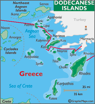
DODECANESE - GREECE |
|
April 22/09 We had a successful checkout in Datca, quick and painless, but the anchorage sucked a big one and we spent a sleepless night rocking and rolling and bobbing all over. |
|
|
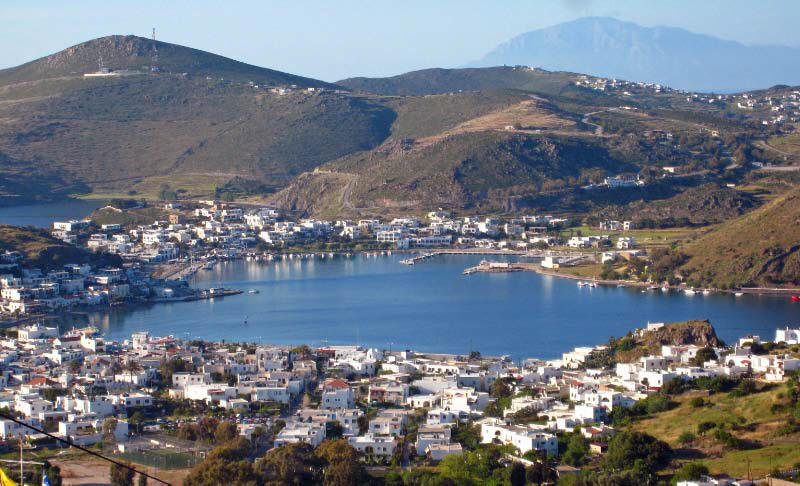
The first group of island we visited were in the Dodecanese, the group of 12 islands that lie in a chain down the Asiatic Turkish Coast. The Dodecanese are the tops of mountains that stood on the plain of the Aegean long since flooded. Most of the islands are bare of vegetation but the villages are interesting and the people very friendly. What we really enjoyed the most about these islands is the opportunity to tie up free to the town quays making visiting the land based sights easier. |
|
|
|
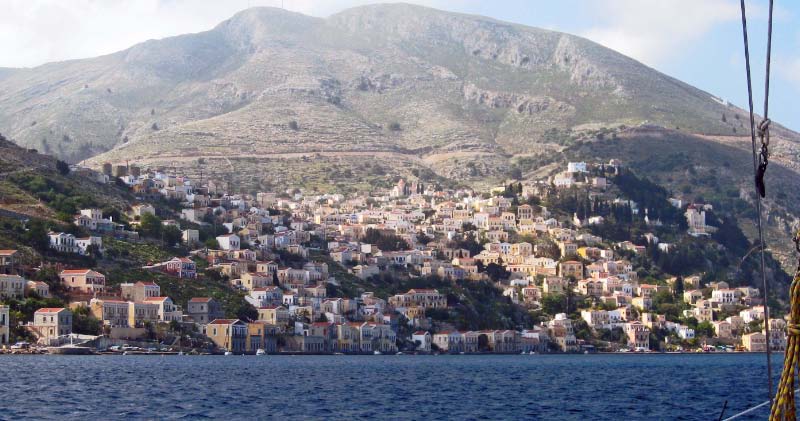
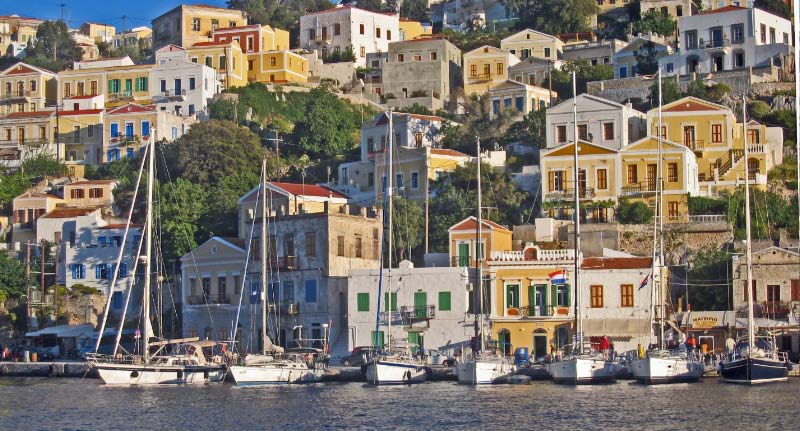
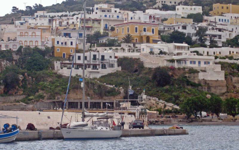
36.37.09N 27.50.40E April 23/09 We bashed our way to Symi and this time entered the main town harbor astonished by the clusters of cubic muted blue, amber, cream and rose-hued houses and painted shutters spilling down the treeless hillsides. We were comfortably tied against the wall, as were several other boats, when a substitute harbor master told us we had to stern tie. We spent the majority of the day in a fiasco, helping everyone making several attempts (including us) to not cross anchors and get secured to the wall. We checked into Greece and the EU, purchased our cruising log and got our passport stamped. We are still uncertain as to how the regulations requiring that non-EU visitors leave the Med after 3 months. We shall see.... pictured is Ascension tied at the town quay in Symi |
|
|
|
|
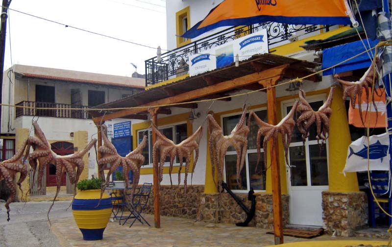
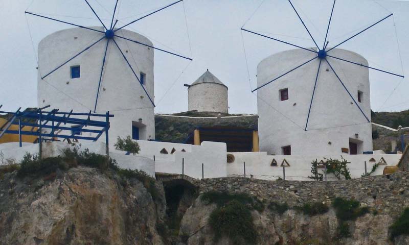
We met a group of Swiss charterers who invited us onboard for Risina, the local wine made from pine resin. It was surprisingly good and really suits the landscape of the surroundings. Later we enjoyed wandering the streets people watching during the busy nightlife. The shops were all open late and we noticed that many of the shops sold sponges, as Kalimnos is known for its sponge divers. |
|
|
|
|
|
||
|
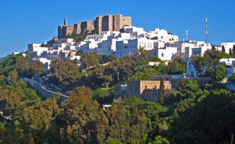
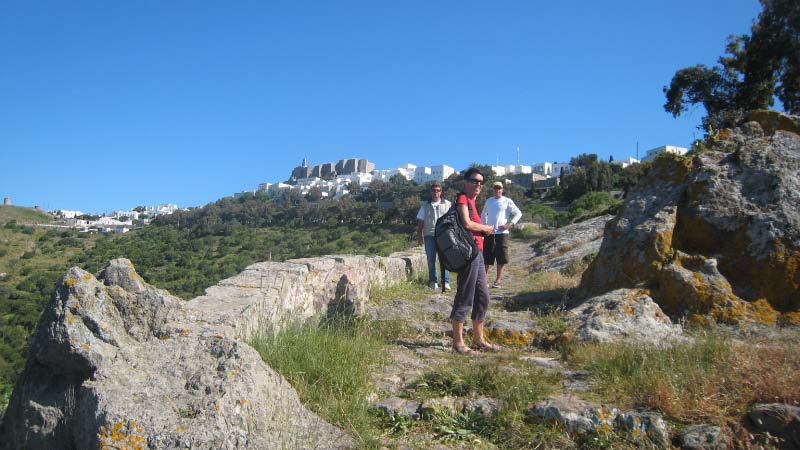
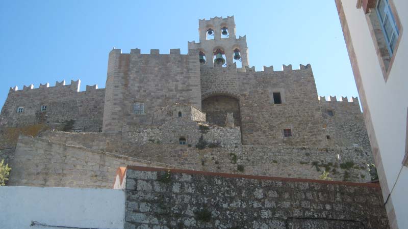
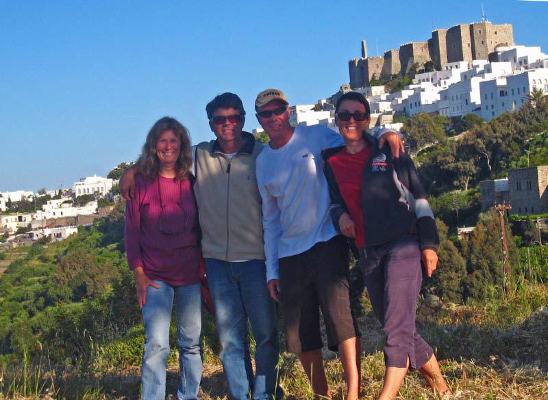
We met up with Mark and Amanda from Belvenie and hiked up the hill to the 11th century Monastery of St. John above Chora, where St. John wrote the Book of Revelations. One of the richest and most influential monasteries in Greece, its towers make it look like a fairytale castle. |
|||||
|
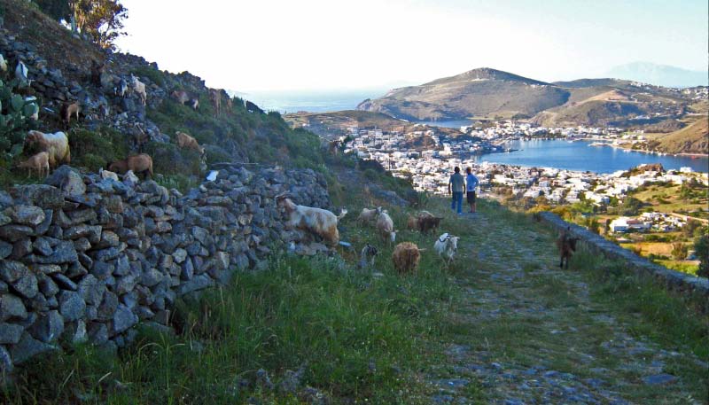
It was a beautiful bright blue day, perfect for some badly needed exercise. The old cobblestone Byzantine trail afforded great views of the anchorage as we meandered through a herd of goats munching on giant cactus. |
|
It was a long hot climb to the top. Between some of the steps you had to walk 3 paces uphill to get to the next one, this was serious exercise. |
|
|
|
|
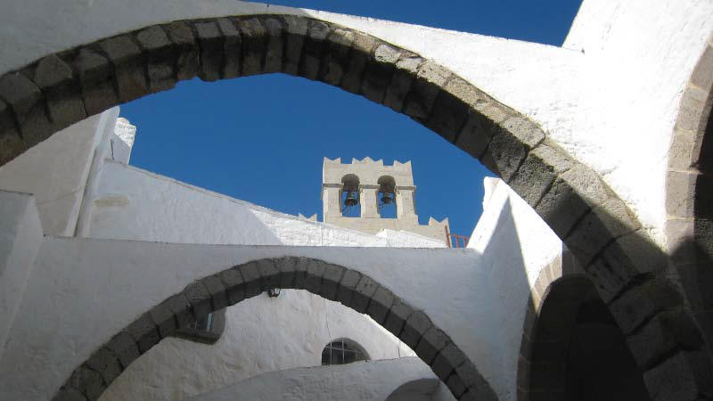
At the summit the magnificent old church was adorned with frescoes and a prominent bell tower. The impregnable fortress-monastery had a balcony over the main gate which boiling oil could be poured on anyone attempting to enter. |
|
|
|
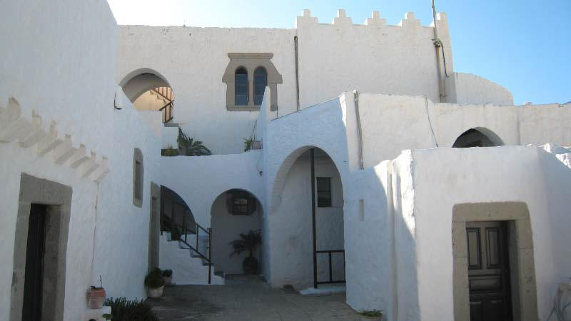
We explored numerous terraces, covered walkways and the even the original kitchen with a petrified wood hollowed out tree trunk used for kneading bread dough. |
||||
|
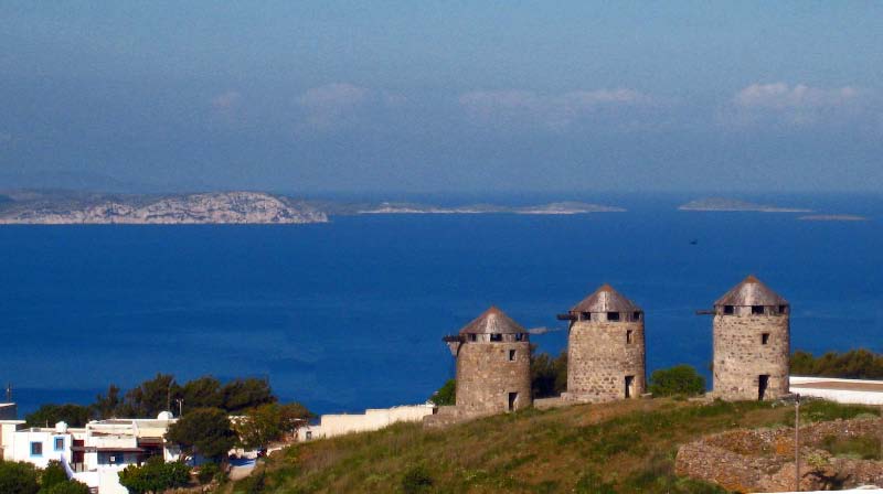
The ancient town of Chora with its glaring white squat houses, surrounds the hilltop church and the warren of narrow stairways of streets and twisty alleyways ambling through a maze of over 40 monasteries and chapels |
||||
|
Getting propane tanks filled is always a chore but an almost impossible feat in Europe. No where will they fill American/Cdn bottles. Greece uses Greek Gaz in tanks that can only be exchanged. But the fittings on these tanks are all different from what we use in North America and do not fit in our lockers anyway. So Gord rigged up Greek-type fittings and hoses to attach to our tanks, rented a Greek tank and transferred the gas from the Greek bottles to our Canadian ones. Highly illegal here but our only option. An all day job so good to get that out of the way as we don't want to run out of gas before morning coffee!! |
|
May 3 Finally we set sail for Mykonos, anxious to meet my bro, Bruce for a visit. Mykonos is in the Cyclades group of islands on the western side of Greece mainland. |
|
|
NEXT>>>> THE CYCLADES, GREECE |
|